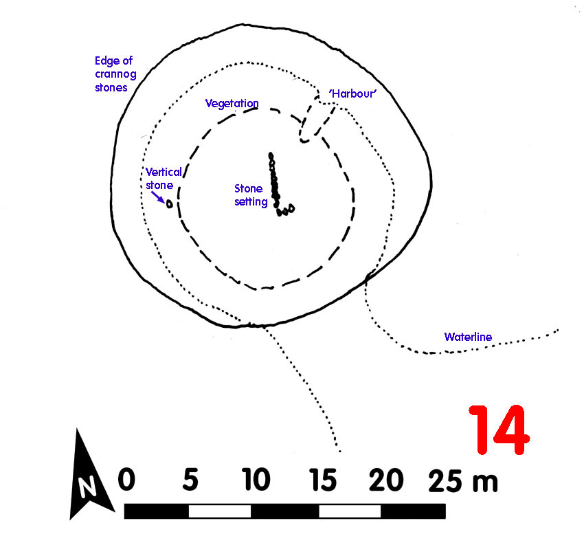
Crannog 14 Loch Awe[click on graphics for larger view in new window] |
Location: Rockhill
Map reference: NN 072 221
Date of Survey: 26 September 1972
Loch level OD: 35.448 m
Highest point of crannog OD: 36.898 m
Top to bottom of crannog: 2.7 m
Overall spread: 25 m x 24 m
Usable area: 14 m x 13.5 m
Description (1972): Mature trees and grass. A line of stones leading to rt angle corner in centre. To NNE a modern 'harbour' or boat slip. Small stone chips visible below larger surface stones. Where the stones had been robbed from the top of the crannog, three pieces of timber visible below. On the W side of the crannog, a vertical stone stuck out of the surface.
On SE joined to the muddy shore by a mud causeway, too soft to walk on. Deep mud surrounded the crannog and at several places between 20 m and 50 m to the north there were timbers lying on bottom and curious troughs 3-4 m long cut out of the mud, perhaps the result of marl dredging?
Finds:
Dating:
Post-1972:
CLICK TO ENLARGE

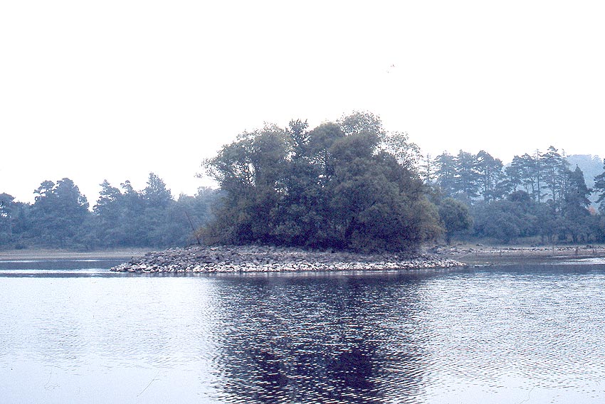
In a small bay, Crannog 14 was quite close to good farming land onshore, but difficult to get to, due to the sticky mud all round
Back to front page